Monday, October 31, 2016

We find either an unusal rock or a Native American artifact: Read on to see which!


Vicky found it in front of our pickup.  It looked like it might be a Native American mortar--where they would use a rock to grind up grain.

What do you think?


We contacted the local office for the Grasslands, and it was very responsive.  Two people from their archaeology department came and checked it out.  That is nice to know about the Forest Service.

The verdict?

Not yet.  Be patient.  Sheesh.

OK.  I will admit to some mixed feelings here.  Vicky found this, and also found the 30 million year old fossil last month.  She is always finding things.  She can look around at the horizon and point out something of which I was unaware, and still see what is right beneath her feet.  And I just blissfully hike along.

So, I'm feeling a little artifact-finding impaired.

Also, after we found it, hiking became impossible.  Every two feet Vicky thought she saw something, and we'd have to stop so she could pick it up.  After all, she was on a roll.   And who am I to say since she finds, like, everything and I find, like, nothing? 

But I hoped it was an artifact anyway.

So, now, with that.  The verdict?

An interesting rock.   

It will look great in our garden, and be a reminder of the fun we had with this. 


Saturday, October 29, 2016

Quicksand, Daddy! Quicksand!!! 60 years between trips to Badlands National Park


When I was 8 or 9 years old I went with my family to Badlands National Park (at the time it was Badlands National Monument).  I remember the trip vividly, even though it was some 60 years ago.

This is a video of the 8mm my father took of that trip.  You can see Kathy and me running around, with me carrying my trusty toy rifle:


My most vivid memory of that trip was of a frontier fort somewhere near the Badlands.  I don’t recall the name, and my parents are both dead so I can’t ask them.  From my search on the internet, my best guess is Fort Phil Kearney.  It is the only Fort that appears to be like the ones that were so common in 1950s westerns—made of sharpened logs set into the ground.

Fort Phil Kearney:


Here is a shot from our 8mm movie of the fort.  Not easy to make out--cameras in those days had no automatic exposure meters on them, so it was usually guesswork about the lighting.  And the films have degraded of the years, plus the transfer to DVD resulted in some lost clarity:


During this trip I carried (for protection, even though I didn’t have a Concealed Carry license) my Hubley Old Betsy rifle.  It was a sort-of replica of Davy Crockett’s Old Betsy, as Davy Crockett was the Harry Potter of its day.  All boys had Old Betsys and wore coonskin caps and were Kings of the Wild Frontier in our backyards.

Another staple of TV and movie westerns of that era was quicksand.  In these shows, if you stepped into quicksand, it quickly covered you up—sometimes forever.  However, quicksand isn’t really like that, but what it is really like isn’t very much fun.

Here is a great example of 1950's TV's depiction of quicksand, one I found on Youtube.  It is from The Rifleman series.  It is a lot of fun to see it now.

Sinking up to your head in quicksand:  Every 1950s boy's nightmare

While at the fort, I thought it would be fun to sneak up on it. So I handed my father Old Betsy and told him I would be an “Indian’ attacking the fort, and he was to shoot me as I approached it.  He gamely agreed, and waited at one of the windows to get me.

I ran out of the fort and into a pool of water that was hidden because grasses were growing in it.  About ankle deep.  I immediately panicked and thought back to all of my westerns for guidance and yelled ‘Quicksand, Daddy!!!  Quicksand!”

Then I walked out of the pool.

But I never walked out of the all-in-fun ribbing about it.  For the rest of my parents' lives I heard about it.  What I wouldn't give to be running out of that fort once again, attacking my father who stood guard with Old Betsy.  Or to hear him tell the story once again.

Thursday, October 27, 2016

Hiking & Camping in the Oglala National Grasslands, NE. Navigating public & private land.

This place is what you might imagine when you think of "grasslands."  Miles of grass in every direction.  It is beautiful.


As it is in all of the National Grasslands, some (sometimes many) areas are privately owned.  And it is frequently unclear what land is public and what land is private.

While hiking in the Oglala, we found a section where the boundary between private and public lands was actually marked-------backwards.  The signs indicating private land were on the wrong side of the boundary. 

Here is an example.  Vicky (illegally) leaned over the fence into private property to read this sign (so her head was violating the law---let's pray for mercy).  However, the area "beyond this sign" (where I am standing) is actually public land.  The private land is on the side where you can read the sign.

All of these signs need to be on the opposite side of the fence.

This is going to mess up the thousands upon thousands of people who come here to hike......or maybe it will confuse the two (us) who came here this year.  One or the other.

But it once again shows the difficulty in using these lands for recreational purposes.  Public lands interspersed with private lands, usually with no signs or, in this case, incorrect signs.

But it sure is beautiful.  Our site is quiet, with virtually no other people using the road that is 1/4 mile from us.  Isolated.  Just miles of grass and wind.  


Tuesday, October 25, 2016

We find a 30 million-year-old fossil in Badlands National Park. We are stoked!!!


While hiking a couple of weeks ago in Badlands National Park, Vicky looked down and saw something.  It was not like other skulls we have come across, so we didn't handle it.

Instead, we took photos, a GPS coordinate, and sent the information to Park Headquarters.  We didn't make a blog entry about it until the Park Service had time to check it out--we didn't want anyone else locating it. 


It is at Vicky's feet here.


We got word back this morning that they had located the fossil.  Here is what we got:

We were able to relocate the fossils that you found by navigating to the GPS coordinates you provided. The fossils you found include a skull and lower jaws from the oreodont Merycoidodon. Oreodonts were a common and diverse group of herbivourous mammals that have left no modern descendants.

The orange color on the bones is due to oxidation of the iron bearing minerals trapped within the bones during fossilization. It is common to see iron staining on bones at Badlands National Park, particularly in the area of (we X'd out to keep poachers out of the area). This is due to higher concentrations of heavy minerals in the sediments such as Iron and and in some areas, Uranium.

The fossils were weathering out of sediments from the Scenic Member of the Brule Formation. Fossils found in this rock unit are around 32-30.3 million years old and are part of the Oligocene Epoch of the Paleogene Period. This time period was roughly about half way between present time and when dinosaurs roamed North America 65 million years ago during the Late Cretaceous.  


Here is a photo of the animal:


It's not like we found a Tyrannosaurus Rex or anything (although we were sort of hoping that it was an as-yet undiscovered species so it could be named VickyusDanus Rex).  But we are pretty pleased with our find.

Monday, October 24, 2016

Bury my heart at Wounded Knee.....even now, 120 years later

We both wanted to visit the memorial to the hundreds of Indians who were slaughtered at the 1890 Wounded Knee site.

It was sad.  It was an event that is a shameful part of our history where so many lives were needlessly taken.  We thought of the site as a Native American equivalent of the Arlington National Cemetery.  Sacred ground.

It is on the Pine Ridge Indian Reservation.

We drove to the site to find.....a sign.

And a group of individuals who wouldn't leave us alone.  Wouldn't even let us read the sign--standing between us and it.  Trying to sell us cheap trinkets or panhandling for money.

We felt we were at a holy shrine, but that it had been desecrated. 

We stopped later at a gas station on the reservation, and were once again accosted.  I had to tell people to leave me alone, and then later found that they had sneaked around the camper and had knocked on Vicky's window to hassle her.  Bothering a woman like that after being told to go away?

We left without making any purchases.

We will avoid the Pine Ridge Indian Reservation in the future....sadly.  

Can this problem be solved, please?  I know it is complex, and I know people of good will want it to be fixed, but an air of hopelessness hangs over this entire place.  It is not what our country is all about. 

Sunday, October 23, 2016

Leaving Buffalo Gap National Grasslands & Badlands National Park, South Dakota

Today will be our last day here at Buffalo Gap National Grasslands, just outside Badlands National Park.  We have spent the last 10 days at a terrific spot, far off the road.  We have had NOBODY come by our area in those 10 days.  That's the isolation we love.  We camped in four different spots in these Grasslands and hiked in every direction from our campsites.  We will have been in these Grasslands three weeks when we leave tomorrow. 

We hiked over 100 miles here.  Different beauty and different kind of hiking than we have done before.

Tomorrow we head toward the National Grasslands in Nebraska, Kansas, and Oklahoma.  We are out of propane, food, and space for trash.  We also need water.

And winter is coming--time to head south.


Monday, October 17, 2016

Dancing Across the USA: Our 4th Camping spot in the Buffalo Gap National Grasslands, South Dakota: A DANCE FLOOR!

We are now at our fourth camping spot in the Buffalo Gap National Grasslands.  We are nestled up against Badlands National Park (literally a few feet away).  This give us the best of both worlds---we are allowed to camp in the Grasslands and hike in the Badlands.

We have been here seven days now and not a single other car has driven to the end of the road where we are.  Such privacy.  And beauty.

Most days it is windy.  And nice. 


Our site:


One reason we chose this spot is because of the fairly large and flat dirt surface next to us.  We realized that we had found a dance floor.  

So, of course it was imperative that we used it.


Here we are dancing:


Some photos of our hikes from this spot:


One day we explored up a small, narrow canyon (of which there seem to be few here).  We thought we might be able to get to the other side of the small mountain range.


As opposed to other canyons, which are primarily formed from rock, these are all dirt.  That's because that is what the Badlands hills and mountains consist of--dirt.

We had to stop when we ran into a rattlesnake.  He was unwilling to budge.  That's his call.


We found other interesting wildlife in this small, narrow passageway.

One time I stepped on what looked to be a damp spot to find out that it was actually a few inches of mud.  And I sank into it (and made a mess of my shoes and pants).

Out hopped a frog that had been hiding in it.  A good sized one, actually.  About 4-5 inches long.


See it?  It uses the mud for camouflage.


We also saw a Praying Mantis having its dinner.


Thursday, October 13, 2016

Little House on the Prairie: Buffalo Gap National Grasslands, South Dakota

Here is our latest camping spot.  Right in the middle of a sea of grass:


We're there.  Look hard.

Tonight will be our third night in this spot.  Both nights have been COLD!!!!  We piled the blankets on and made it through.  But days have been wonderful for hiking.


See Vicky?


Our camper is in this photo, about right in the middle:


Tuesday, October 11, 2016

A weird aspect of our National Grasslands: Most of it is private!


The National Grasslands are large areas that are primarily in the upper mid west.  They were formed when the Government bought back useless land from people who homesteaded these areas around the turn of the 20th Century.

What was learned was that when these people settled the land it was in the midst of an usual climate spell---there was rain and the land was good.

However, that is not usually the case here, and the land was basically destroyed.  To keep the farmers from going under, the government purchased the land from them, and set about attempting to restore it.

And, based on what we have seen, the government gets an A+ for this.

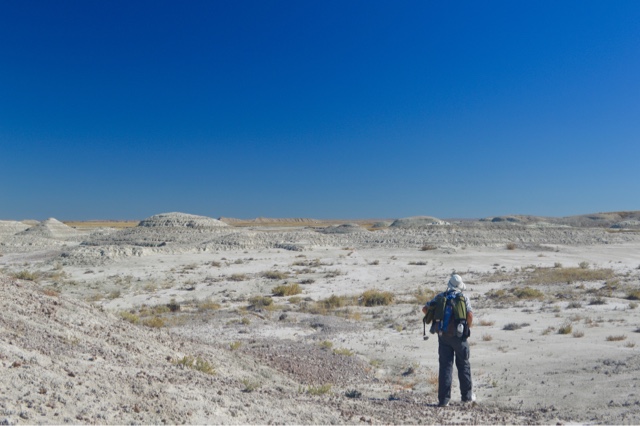
But trying to camp and hike in these areas is a challenge that is different from other places we have gone.

The big reason is that a huge amount of areas within the official boundaries of the Grasslands are private.  It requires a lot of planning and effort to be able to camp and hike in these areas and stay off of people's private property.

For example, here is one of the National Grasslands, as displayed in our Road Atlas:


I have made an outline of the area in red.  Inside, it is all green--indicating it is all National Grassland.  That is what we initially saw when we thought about visiting these Grasslands.  Wow!  Look at all the places we can camp and hike we thought.

However, here is the map you get when you contact the Grasslands office itself and pay for one:


The outlined area is the official boundary, as shown above.  As you can see, within that boundary most all of the area is colored white.  That represents private land.  Only the green areas are public.

So to visit these areas is extremely tricky.  We can only do this because Vicky got the correct maps ahead of time, and because we have a sophisticated GPS device with a map of public lands on it.  Without that, we would not be able to enjoy these National Grasslands.

We choose our camping spots to be places where there are a lot of public lands in most directions.  Before we hike, I draw the areas that are private so that we can avoid them.   An example is below.

The black line is our hike.  The areas shaded yellow are public.  The area shaded blue is state land.  You can see how tricky it was to avoid private property.  For the most part, the areas that are private are not marked or bounded by fences. 


We are glad we have visited these National Grasslands, but do have to say that it requires a lot of planning and know-how to be able to know where one can go on them.

We don't say this as criticism, as what the government has done over the past 80 years is simply remarkable.  And, in fact, for us this is a good thing because we are more likely to find the isolation we seek in places like this.

Just know that if you are planning on doing what we did you need to be prepared in a way that you don't have to be prepared for in other public places.

Sunday, October 9, 2016

More hiking in Buffalo Gap National Grasslands and Badlands National Park: South Dakota


We are camping outside of Badlands National Park because the park does not allow us to camp anywhere except in campgrounds.  We have seen one of the two campgrounds, and photos of the other.  Why are most campgrounds planned in such a way that there is no space or privacy between sites, especially places where there are hundreds of square miles to spread out?

So we are camping in the National Grasslands just outside the park, and hiking in the Grasslands and Park.

Our camping spot for these hikes.  We were here for five nights.  Quiet, peaceful, isolated.


Photos of our hikes:


Our camper is on the horizon.