
Today we hiked the Orcut Trail in the northern part of the park. From the trail map it looked as if it started from a trail head on the road and then went to the edge of the Saguaro National Park. We weren't expecting much in the way of beautiful views, but not every hike needs to be a peak (ha ha) experience in order to be worthwhile.
As I have mentioned in a blog post about another hike in this park, the trail map we were provided is very nice, although the trails themselves are not marked particularly well. At most places we hike there is some kind of sign at intersections, but those are relatively rare here. That is a problem because in the desert people can easily create new trails by cutting between existing trails. So there are frequently unexpected intersections. I have an expensive hiking GPS that helps us know where we are, although at times we could find the correct trail with both it and the map.
There is also a relative lack of cairns marking the trails.
Overall it gives the feeling that someone needs to take a small crew and spend a week re-marking the trails and placing a couple hundred dollars worth of new signs in strategic places. It isn't a particularly wild place, so getting lost would likely not be the same as getting lost in the Cascades, but it would be somewhat safer and more fun.
One way it would be safer is if people failed to bring adequate water, which Vicky said her sister Diane, who hiked the Tucson area a lot, frequently encountered--Diane carried an extra bottle of water on her hikes just for these people. She said a lot of them were lost. Isn't that a nice thing about her?
The trail today was easy to follow by using the map and my GPS. In the trail map it is listed as the Orcut trail. I had difficulty finding anything about it on the Internet, which was a bit puzzling.
The reason is that the actual name of the trail is the Orcutt (2 t's) Trail.

Someone might want to correct this on the next version of the hiking map.
Most of the trail follows an old dirt jeep road, one that hasn't been used for vehicle traffic for a very long time, as a few Saguaro cacti in the middle of it will attest.
When you get to the end of the trail (about 3 miles later, with a climb of about 900 feet) you leave the United States, apparently.

We aren't sure what country we were in, but thought it would be fun to say we had lunch in a foreign country, so we did.

At this spot we found another old sign, one announcing the entrance to the Saguaro National Monument. It was a National Monument until 1994 when it's status changed to be a National Park.

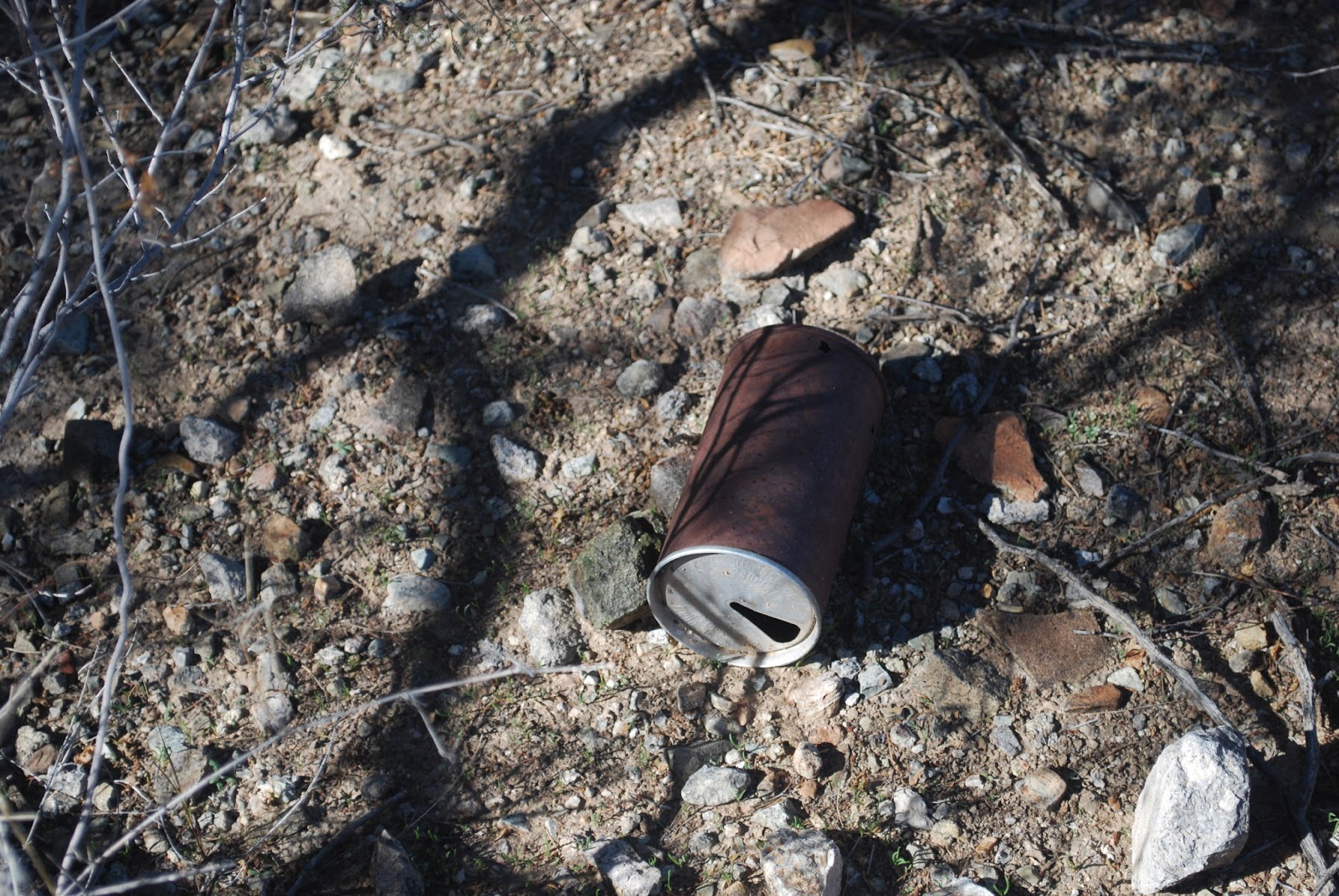
On our way down we had fun looking for old pieces of metal and tin. None of them should be there, of course, but they were.
Pull tab can:
Which dates it to before the early 1970's.
This one is even older (the can, I mean).


"Easy Opening Newest Aluminum." Pretty cool.
Our last fun sign of the day was a trail sign. Literally. It was a sign that simply said "Trail." Never seen one of those before.

Today we had fun on the "Trail" hiking to visit the Saguaro National Monument in a foreign country on either the Orcut or the Orcutt trail searching for old rusty beer cans.
Orcutt Trail:

Get with the program: Congress has seen to it that national parks are chronically underfunded, resulting in campgrounds and other areas being shut down, fewer rangers, less trail maintenance, cuts to educational programs, damage to beloved and historic sites, and cuts to research, including monitoring of endangered species. Good thing you like picking up garbage, no one else will. Think about also carrying paint and signboards. On the plus side, you can now carry weapons in national parks, and corporations work ceaselessly for the right to drill for oil on protected lands. Thank a politician today.
ReplyDelete