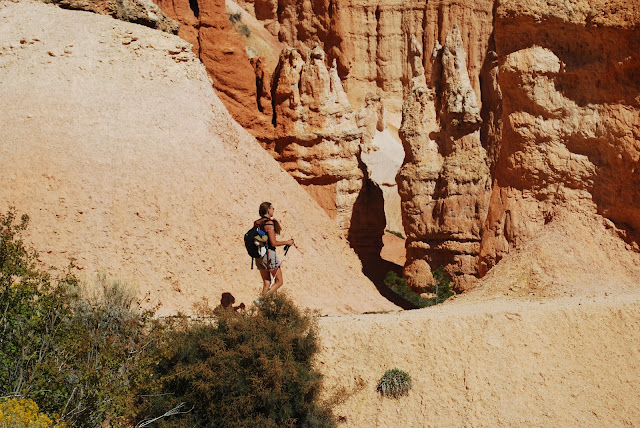
The trails at Bryce Canyon roam around the rim (the Rim Trails), descend into the canyon and then back out again (like the Navaho Loop Trail we did our first day here), or descent into the canyon and then you wander around inside it (like today's).
Our plan was to descend into the canyon (which we knew to be a descent of 500-700 feet, requiring that many feet to ascend when we were done), and then hike around the inside of the canyon where it would be relatively flat.
We quickly realized that we were just making this up. Or making up part of it. Yes we did descend about 700 feet into the canyon, rapidly, along trails that must have been difficult to create but are really magnificent. However, the 3 mile loop inside the canyon was NOT flat. Instead, it was like cycling on Whidbey Island--up and down, up and down, up and down, to the point that when we reached the end of the loop and had to ascend to the rim we were pooped.
But that's OK. Great exercise, and even though there were a lot of people, at least it wasn't wall to wall people like it was at Zion or here at Bryce on the Navaho Loop Trail. The hike was 5 miles, with 1700 foot elevation gain. I've mentioned this before, but the elevation here is high! We began the hike at 8300 feet! For reference, this is 800 feet higher than Estes Park Colorado, a place where many people are affected by altitude sickness. Although we are getting used to the altitude, it still has an effect on us when the hike is strenuous.
The first photo shows the descent from Bryce Point. As I have mentioned, these trails are incredible--you descend rapidly on well-maintained switchbacks down an almost sheer side of the canyon. Hats off once again to the National Park Service. We descended 700 feet or so in one mile.
Then we caught the Peek-A-Bo Loop trail. I could try to describe it in words, but sadly I am not skilled enough to convey the beauty of this place in words. I'll have to let the photos do the work for me.

We found a shady spot under a tree and had lunch. The shade was appreciated.
I neglected to mention one other aspect of the trail--it is also used by horses. Fortunately horse poop doesn't smell too bad, so you just sort of get used to it. While perhaps an inconvenience, it is more than made up for by the fact that dogs are not allowed on the trail. Dogs on trails annoy me because (1) usually they are large, and (2) often the owners allow them to run right up to you, cheerfully announcing that "he's friendly!" Like I'm supposed to know that AND like their dog as much as they do. I got told that on a recent hike about a Pit Bull. "He's friendly!" Well, I'm not.
So, give me horses anytime, even with their poop.
Today's nature photograph. A bird that was sorting among the horse poop for seeds. I've tried to identify him, but can't, so have sent the photo to my friend Linda to help me. He was a little more teal in color than the photograph indicates.
She also said:
"It's possible that someday the American Ornithological Society will decide to split the races of the Dark-eyed Junco into separate species."
Isn't that interesting that there are still issues with classifying birds?
Hike Report: Peek-A-Boo Loop, Bryce Canyon National Park, UT
(Note that the elevation gain changes a bit when one disables the elevation correction. Note also that, as is typical with both my hiking and biking Garmins, elevation gain does not always equal elevation loss, even though we always start and stop in the same exact location; I basically take an average of all of these figures to arrive at what I believe to be the best estimate of elevation gain. I also use data from two different Garmin computer programs, which usually provide slightly different estimates (one Garmin uses Google Maps and the other uses barometric pressure to estimate elevation). The figure I arrive at is probably accurate to within 50 feet or so, which is pretty good. Also, usually it is within a few feet of elevation gains provided on the occasional trail map that reports elevation gains of hikes, which makes us feel confident in what we estimate when this information is not provided by trail maps.)


No comments:
Post a Comment