
LL


As it was in much of the desert southwest, mining played an important role in the area that is now the Mojave National Preserve. From what we understand, none of the mines in this area are currently being worked. However, there is evidence of them from the mid-1800s.
One place where there were many of them is the Old Dad Mountain area, in the northern part of the Preserve.
We spent four days hiking this area, finding mines dating from the late 1900s, shacks, rusted equipment, and stone houses. We had some general ideas about where these mines were from our maps and from a hiking book, but mostly we followed old mining roads and trails and did a lot of cross-country hiking when necessary.
After awhile we got to know the area pretty well, and understood the relationship among the various mines.
As has been the case whenever we have spent time in the Preserve, we saw no other hikers. We saw some people out riding in 4WD vehicles on the many dirt roads, but that’s all.
A few of the mines can be accessed by these dirt roads, and there was evidence that people had driven to them. Whatever floats your boat, I guess, but for us we get a much better feel of the place when we are on our feet. So, with few exceptions, the only roads we took were old mining roads that had been closed to vehicles years ago.
In addition, the maps aren’t accurate and it was fun discovering the places on our own. There is a special kind of thrill to hike up a steep hill and then find a mine by looking down the other side.
We hiked over 26 miles in this area. Not only is there a lot of history here, but a lot of beauty and solitude as well.
Brannigan mine
We will start by describing our route to the Brannigan mine, even though this was not our first hike in this area. It is the oldest mine, and the road we are camping on is named for it. We found the location thanks to a book by Michael Digonnet. His book on hiking in the Preseve is full of useful information. It is a gem and we strongly recommend it. In addition to the hiking information, there is a lot of fun history provided--unusual in books of hiking trails. One piece of information he provided in this book is that the site of the mine listed on the maps of the area is incorrect. We found this out the hard way, as we describe in a later hike on this entry of our blog.
After he wrote his book, however, part of the road one uses to get to the correct spot of the mine has washed away, so we had to do a little hill climbing to find the right spot to leave the desert and head up a wash.
Below is a map of our hiking trail. The map shows all four hikes we did in this area. TH stands for "trail head," although there is no standard trailhead for these hikes. It means our starting place. The Brannigan Mine route is in black. The "Trailhead" for this hike is on some rough roads, of the kind that only 4WD vehicles should attempt. And even so, expect problems, as we showed in our previous blog post of a piece of mesquite in the wall of our tire. And believe me, we were always on the road, and got this arrow through our tire anyway. No off road stuff for our dually. Even it, with All Terrain tires is not really suited for travel on many of the roads in the Preserve.
We almost had to start this particular hike on this rough road because the distance would have been too daunting for us to begin it where we began the other three hikes we took in this area (i,e., off of Kelbaker highway).
The orange dots show the trail you should take.
Follow the Brannigan mine road (this right fork of it) until it ends in a wash. Follow the orange dots below, which avoids turning off of the wash/road too soon as we did.

Follow the wash south and enter between the hills shown here:


Check out the workmanship of the rock interior.

Now, the bad.
Apparently there was or is a program in the desert Southwest called Adopt-a-Cabin. Your group adopts an old mining cabin and..................... The rest we aren't sure about.
We have seen some of these. And can't tell from looking at them exactly what the purpose of the adoption is. Some, like this one, have had "improvements." These "improvements" consist of new vinyl windows, sloppily thrown into the previous window openings, providing a garish appearance in an otherwise fascinating shack.


There were more of these windows inside, waiting to be installed, along with new tools.
In addition, this was inside:

The old chimney, which was still attached when Digonnet published his book was taken down. Wouldn't it have been cool to see it still there?

We saw a cabin in the Copper Cove area that was part of this program, apparently, and it appeared the group was trying to retain the cabin in the state it was when used. This was a bit easier for them because the site was much more recent, as opposed to the Brannigan mine which began operation about 120 years ago. We can't say for sure about this group in the Copper Cove area, though, but we talked with some people who were there for the day to do some work on the site.
We have written to the Preserve authorities with questions about our concerns regarding this dugout and the Adopt-a-Cabin program. We will report back, as I am sure we have valid concerns and are not just cranky old people telling others to "get out of my yard!!" Right? RIGHT???
------------------
Addendum: we received a prompt reply from Preserve officials regarding this cabin. The alterations were not approved by anyone. The person responding did so in a professional manner and was obviously concerned about what had happened. We were pleased with all aspects of his response.
-----------------
Sunrise, Gold Cycle, and upper Paymaster Mines
This was our first excursion into the area. Our hiking book recommends starting all of the hikes to the area from the place where we started the Brannigan Mine hike, but that "Trail Head" involves some rough roads with deep sand in spots. We started our other ones from just off of Kelbaker road. Anyone with any vehicle can just pull right off this highway and head into the hills. Doing this made figuring out where we were vis-a-vis Digonnet's book tricky for us since our beginning point wasn't on his maps. This hike is highlighted in yellow.

You follow an old mining road that is clearly visible from the parking spot (the bottom part of the loop in yellow). It goes up and over a hill, with several of these stone structures along the way.

Hike it to the bottom where it meets a road that goes to the left and can be seen in the distance rising sharply or to the rIght down the valley. Go left.


Alhough the above photo was taken on a different hike, it shows a nice panoramic view of the area we went to. The photo above of me on the steep road was going to the Sunrise Mine. And the photo of me on a mine opening reading Digonnet's book is that mine.
We hiked over to the left of the photo and saw several other mines, but didn't know what they were at the time, hence the question mark after the word "Paymaster." We found later that it was the Paymaster, which we labeled for our use as the "Upper Paymaster." The reason will become obvious later.
We returned the way we came until we got to the Y intersection and instead of going right the way we entered the area we went straight down the canyon to a wash where the Mojave Road met up with it. We followed the wash around the top of the area back to our vehicle.
We weren't sure where we had gone until we got back to our camper and could compare maps. We knew we had missed many important areas, including the Brannigan Mine, so decided to go back for more after a couple of days hiking in other areas. Remember, although we have described how to get to the Brannigan mine, we didn't know this at the time.
Failed search for Brannigan Mine, but we find the Oro Fino, Blond Beauty, and La Paloma ones
According to our maps, the Brannigan Mine was supposed to be quite a bit north from where it actually is. The next photo shows the erroneous location--the correct one is the last bit of the black tail south of it (below it on the map).

Since we didn't know this at the time, we took the route that we thought would get us there. It is the purple route.

We are glad that at the time we were still a bit unclear where everything was because it ended up being a day of discovery (and a very long hike).
We headed off south from the "Trail Head" and took a different road into the mountains. This road, on our maps, looked like it ended about 1/4 mile before the mine, and that we could pick the road back up about 1/4 mile beyond the mine.
Here I am heading up the road, showing where we needed to go over the hill.

Vicky on this road.


Me going down the other side, within yards of where the Brannigan mine is supposed to be, but isn't.

Close by, though, Vicky found a stake marker.

This is the spot she was in from a distance. No mine! (See her? She's in the middle/left of the photo)

This is what it had on it.

Huh? The Oro Fino mine about where the Brannigan mine was supposed to be?
Not only were we in the same area where we were yesterday, but we had climbed up and down a steep hill for nothing (well, it was cool, though), and at the time we were still figuring out all of the maps).
Here is about where the Brannigan mine was supposed to be:

According to our incorrect map, the Brannigan Mine road should be about 1/4 mile east of where we were, so we headed across the hills to see if we could find it.
Along the way, Vicky found another marker:


Hard to read but it says Gold Cycle claim.
Here is the route we took east across the hills:

We reached a high spot, looked down, and saw mines!
Yeah! The Branngan mine, we thought.
Incorrectly.
Instead it was the Oro Fine mine, as we found out later.
But, hey, a mine's a mine, isn't it? So we hiked/scrambled down the hill.


And found this below:


On down the road was, according to Digonett, the La Paloma mine, which I think is this one:

And two well known cabins close to the mine.


Now here is where we ran into some more issues with the Adopt-a-Cabin issue, if indeed that is what is happening here.
First, a new imitation windmill, complete with new signs.

A security camera?

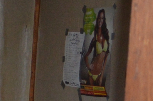
And last but certainly not least, the people working on the cabin had apparently hung a calendar with photos of bikini-clad women. And a sign board for writing cute comments.
Is this the new BLM program for men still stuck developmentally in adolescence?
We tattled (uh, I mean "reported") this to the Preserve, as well. We will see what comes of this.
The cabins were clean, reflective of some meaningful work. We believe it is sponsored by an OHV club of some type.
We just have a lot of questions about who can make alterations in the Preserve and other BLM lands, and what the goal of the alterations is to be and who monitors/supervises alterations.
Traveling on down the road we saw some debris off to the side and so went to the explore. What we found was the remains of a sign indicating the Paymaster mine,


We figured this was the Paymaster Mine, but realized later that it was in the wrong location.....we think.
Traveling some more down the road Vicky saw in the far distance an unusual structure. We figured we had better go check this out, so headed across country, not realizing until later that there was a road to it.
See it in the middle of the photo?


It was all that was left standing of a structure of some sort. An exceptionally well built fireplace or stove or oven or all of the above.
It is standing precariously close to a pit in front of it, probably the original basement.
In terms of historic preservation, it might be a good idea to see if an adopt-a-fireplace group might be able to shore it up--ideally a group who knows something about masonry and construction.
We saw a road leading off from this site, and even though we were tired and knew we had 4-5 miles left back to our truck, we followed it for a few hundred yards. Finding this marker on a hill:


We turned around at this point and left the small valley. Later we found out how close we had been to other mines. But that was for another day and another hike.
We had a long way to go. On our way across the desert we saw a small mound and went to explore. Found someone had dug a small pit and that there was a bottle with a note in it nearby. I thought it was one of those geocache thingys so opened it and found it was some type of claim.
We carefully put it back because we knew from all of the westerns we watched as children in the 1950 that claim jumping is a hanging offense,


From today's hike we could determine where we were using the map Digonnet provided, and knew how to get to the real Brannigan mine, which was the first hike we described on this blog entry.
We also knew how to get from the upper to the lower Paymaster mine.
Hike to the Lower Paymaster mine
As we did with the other hikes, when we could start from the Kelbaker highway we did so. This creates a lot easier traveling than the dirt roads where Digonnet recommends the hikes begin from.
We could see that we had been about 200 yards from the lower Paymaster mine when we found the sign for the Blond Beauty mine. Our route is in blue, below. We went clockwise from the Trail Head.

We followed the route of our first hike, but at the upper Paymaster area took a steep trail down on the other side.


On the way down Vicky looked in the distance and saw the fireplace!


We found the lower mines.


We also found a number of places where rock walls had been constructed to provide for flat spots. Were these flat spots for equipment or for small living spaces for the miners?


This is roughly the route we took down.

Remember the photo from high up showing the chimney? Here is one from the chimney showing the spot of that photo.

No comments:
Post a Comment