
(not to be confused with Big Bend National Park).
Big Bend Ranch State Park is right next to Big Bend National Park. It is huge for a state park, and even by Texas standards it is huge. And it is really the crown jewel of Texas state parks (we can say this with authority having stayed in a grand total of three others).
It is rugged. There is one paved road through it, and that road traverses the park at the very southern part—right along the Rio Grande. It is not quite as curvy and steep as Highway 1 in California, but it comes in a close second. The rest of the roads into the park are gravel and dirt, with most being high clearance or 4-wheel drive. Most of the campsites are in the rugged interior, and all are primitive. It is also a long way from nowhere—in fact the motto for the park is "The Other Side of Nowhere."
We didn’t know what to expect, and where we could go in our rig, so decided to approach it a little bit at a time. For our first visit here, we stayed at one of the actual campgrounds along the Rio Grande. We are not visiting at a busy time, so have the campground to ourselves.
It’s a very nice campground. Composting toilets, and (SHOUT OUT TO TEXAS!) loads of trash cans. In fact, Texas has more trash cans for visitors than perhaps all other states we have been in combined. Even on non-major roads there will be picnic spots every 20 miles or so with trash cans. VERY visitor friendly.
There were no established hikes from our campground, so for our first day we decided to see if we could locate a set of ruins that were identified on one of our maps. We headed off in the direction we thought we should go, up a wash, and then realized that we were on the wrong side of the wash in order to proceed. Now, usually this isn’t a problem—just cross the wash. But this one had a stream through it and was totally overgrown

So we rooted around trying to find a way through it, and low and behold we found a trail up the mountains!
So we took it. It’s not on the maps, and the park people we talked with didn’t know about it. It looked like an old horse trail. And it looked like some people have ridden their horses up this trail recently. It is amazing that they could do this because it was steep and slippery.


We followed it up over the mountain to our north and came to a small mesa with beautiful views all around. We crossed the mesa and in the distance observed what looked to be a huge cave, about a mile away.


So we went into a wash that seemed to head in that direction, and followed it to the cave.
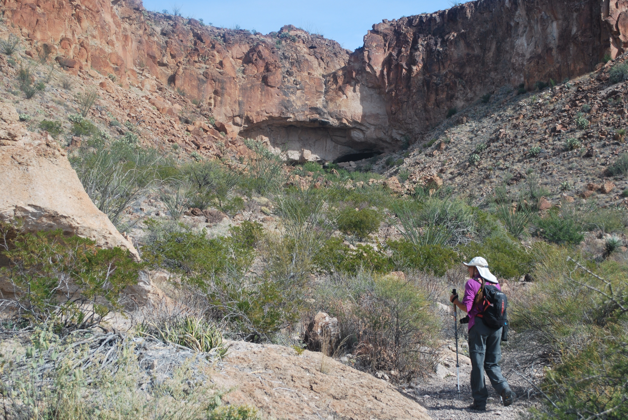

The final 200 feet to the cave consisted of a lot of boulder scrambling, but that was because we missed a trail that would have taken us to it. (Note to ourselves: before boulder scrambling look up on both sides of the wash first to see if someone else wanted to avoid the scrambling and built a trail—this is the second time we have had to learn this lesson).
The cave was fascinating.


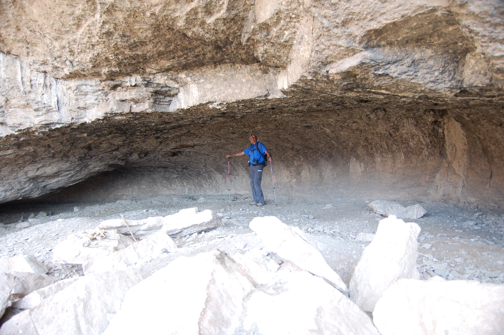

It is clear that large animals have inhabited it. One section was nothing but scat—we labeled it as "where poop goes to die."

It also appeared as if there had been many fires in the cave, as the roof seemed covered with soot.

Our mystery is who built this trail and why. It clearly required a lot of work—it was almost the quality of CCC trails.
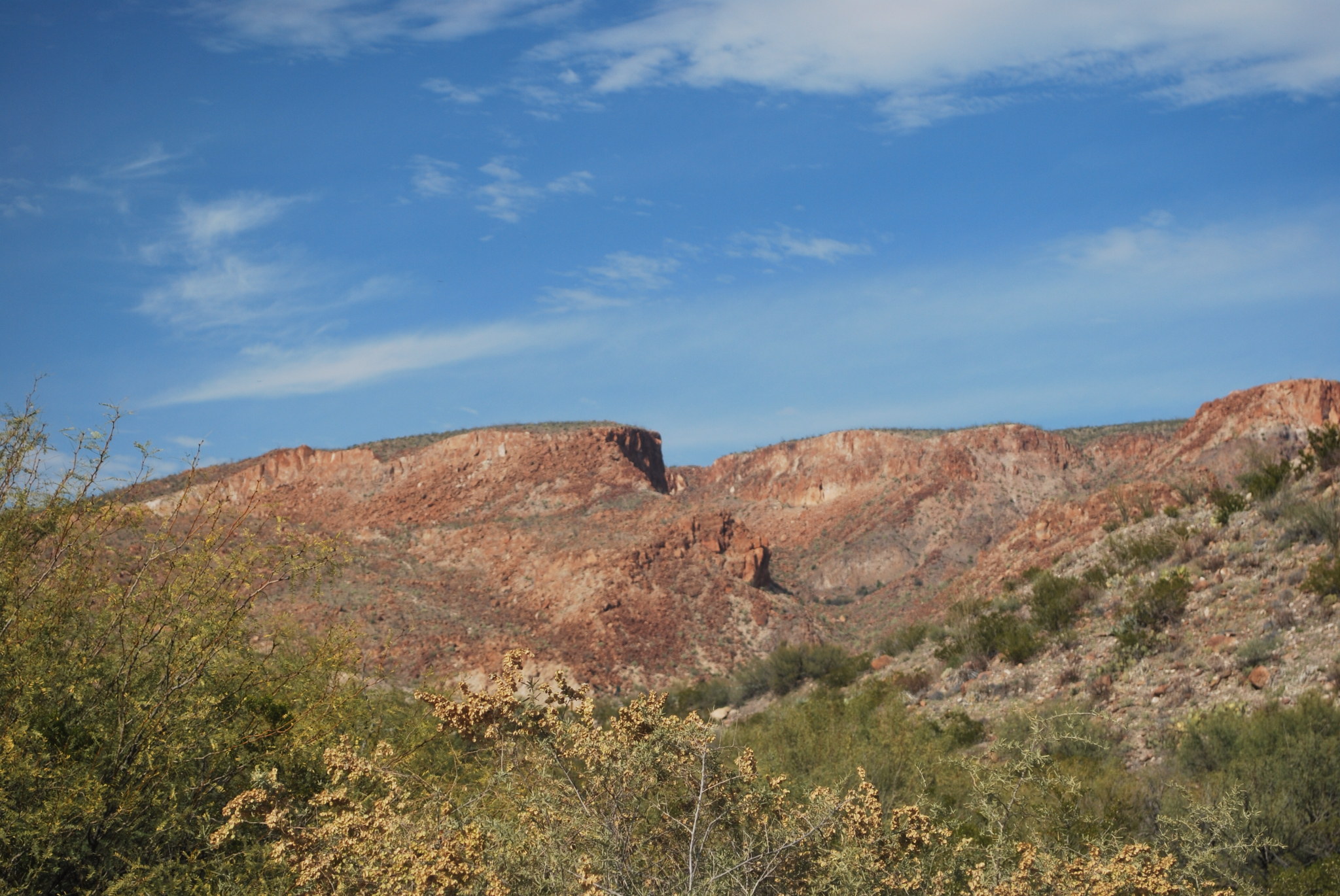
Here is a photo of the mountain we climbed. We started at the base on the right and crossed it to the top left of the photo, where we met up with the mesa mentioned earlier.
No comments:
Post a Comment