Thursday, December 18, 2014

Looking for Frederick Rice in Big Bend National Park

At our campsite, hidden under some brush, is this sign.

Within a few years, this sign will be completely buried in brush, and no one will see it again. Does this matter?

So, who was Frederick Rice, and why does he have a sign where he was raised and I don't?

After doing some research, it appears Frederick Rice ranched in this area in the early 1900s.

We decided that we would spend part of our hiking day hunting for any structures that might remain from his ranch. Unfortunately, where he was "raised" was at a spring, so that in the years since he was here, a huge amount of underbrush has grown up. We fought our way through a lot of it, finding some old tin and old fence, and a place where some short retaining walls look to have been built to perhaps make a garden area?

Or maybe this was the foundation of the home. Could it be?

We also found a large water storage tank (above photo), but no corrals or remains of any home-like structures.

As far as we know, though, other structures could remain here, buried in deep thickets that we cannot penetrate.

We have read that a lot of original structures were destroyed in the 1930s when Big Bend became a national park. From what we have read regarding these structures, probably most should have been preserved. At the time, it appears the priority was on returning area to its natural state, but the amount of history that was lost is a bit sad.

When Bill and Kathy were out with us a week ago, we visited some of the historical structures that remain. Unfortunately historical places like the Nails Ranch and the Sublett farm are rapidly wasting away. Many of these structures were made of Adobe, which is just glorified mud. One could see where the rains were washing them away like a tide washes away a sand castle.

Sublett farm:

Windmill at the Nails Ranch, showing how overgrown the farm has become.

Last year at Joshua Tree National Park we found an old and historical mill high on a mountain trail. It was fascinating, but one could not get to most of it because of the growth of bushes around it. It some point in the future, no one will be able to get to it or see it. And it will disappear until in a few centuries it becomes absorbed into the desert. Is this right?

Should these historical areas be allowed to become overgrown, inaccessible, and eventually destroyed by nature, or should they be preserved? And who decides?

A book by Frederick Rice is for sale in the bookstore of the Visitor's Center here, but yet his ranch is being allowed to waste away and be overgrown, including a sign indicating this spot where we are camping was once a home where he was raised.

Tough decisions the Park Service has to make. Unfortunately, it is one of those situations where one person's decision, say to destroy a structure, can outweigh 20 other Park Superintendents who would have voted to keep and preserve it.

We spent the rest of today's hike exploring the huge wash beneath what we believe to have been the Frederick Rice ranch.

One unexpected discovery, out in the middle of the wash, was two bundles of wire. These would have been worth something at the time they were abandoned. We wondered what their stories were. If only fence wire could talk.

Someone stuck this part to a wheel out in the desert, for some reason. Maybe just to get us to wonder what the reason was. If so, it worked.


Wednesday, December 17, 2014

We create a loop hike from Grapevine Hills, Big Bend National Park. tx

We are at a back country campsite at Big Bend National Park. It is quiet and isolated. Nobody within miles. Just what we love.

Our first day here we headed for the hills. We didn't know where we were going to go, how far, or how high.


Then we started climbing in a southerly direction. Still no idea of where we were going. "Shall we go over there?" "Sure!"

O


After awhile we realized we might be able to hook up with the established trail to the Balanced Rock. We had done this hike to the Balanced Rock with Kathy and Bill last week. We had the GPS coordinates on my map program, so set off in that direction, up and down hills, carefully finding the safest routes.


My GPS unit directed us right to the Balanced Rock trail, except that we were 200 feet above it, with what appeared to be a steep descent in front of us to reach it.

But looks can be deceiving. We have learned that from even a short distance trails and washes can appear to be blocked, but that closer inspection will reveal a route. That is what happened today. We discovered a route to the bottom where the trail was.


Here is Vicky at the trail, looking up the direction we had descended. It doesn't look possible from here, does it?


We followed this trail back to the trailhead, and then took the road another mile to our camper. Along the way, Vicky spotted a formation that she named "Devil's Horns."


We created our own loop trail!


Monday, December 15, 2014

We rent a Jeep!

For a day, to explore the dirt/gravel/rock roads of Big Bend National Park.  Not because we thought we'd necessarily like doing this, but what we wanted to do was to find which of the back country camp sites we could get to in our pickup and camper.

When Kathy and Bill came out to Big Bend to stay the week, they rented an SUV so we could explore and hike some areas off of the back roads.  However, we quickly found out that many of the roads are not SUV-worthy--whether they are front wheel drive or all wheel drive. 

We learned a lot by renting this Jeep.  We found a few sites we could get to in our camper/pickup, and many that would not be accessible, even though the pickup is 4-wheel drive and high clearance.  Our rig is heavy, and the tires, even though they are All Terrain, would not be able to withstand the sharp rocks because of the weight. (We also learned that Vicky does better in a Jeep with her eyes closed.  That way, she isn't gasping when I am trying to keep us from flying off of a cliff.) 

The final thing we learned is that we hated riding around on rough roads in a Jeep.  Noisy, jarring, dusty, and intense.  Such a difference from hiking where everything is peaceful and quiet.  Don't look for us to buy a Jeep anytime soon.

We went on several roads.  The main one we explored is the Old Ore Road.  If you are visiting Big Bend, and want to see the Ernst Tinaja (a wonderful rock formation), you can access the trail head to it by the the southern entrance to Old Ore Road.  However, unless you have a 4-wheel drive vehicle like a Jeep, that's about as far up this road as you should try to go.  A couple of miles past the Ernst Tinaja trail head, the road turns quite steep in places.  The photos here don't do justice to some of the places where the going requires a short wheelbase 4-wheel drive vehicle with 6-ply tires.


Saturday, December 13, 2014

Trail Report: Lost Mine Hike, Big Bend National Park, TX


Kathy and Bill met us for the week at Big Bend.  We did a lot of hiking and viewing of historical structures and had a great time together, as usual.

One hike we took was the Lost Mine Hike, so named because apparently there isn't a trace of a mine anywhere near the hike.  It could also be called the Lost McDonald's Hike or the Lost Walmart Hike for that matter because there isn't a Mcdonald's or a Walmart anywhere close either.

This is a spectacular hike.  it is 4.8 miles round trip, with a total elevation gain of 1200 feet.  You quickly rise to see beautiful views of the Chisos Mountains. 


Saturday, December 6, 2014

Hiking in Big Bend Ranch State Park


(not to be confused with Big Bend National Park).


Big Bend Ranch State Park is right next to Big Bend National Park. It is huge for a state park, and even by Texas standards it is huge. And it is really the crown jewel of Texas state parks (we can say this with authority having stayed in a grand total of three others).


It is rugged. There is one paved road through it, and that road traverses the park at the very southern part—right along the Rio Grande. It is not quite as curvy and steep as Highway 1 in California, but it comes in a close second. The rest of the roads into the park are gravel and dirt, with most being high clearance or 4-wheel drive. Most of the campsites are in the rugged interior, and all are primitive. It is also a long way from nowhere—in fact the motto for the park is "The Other Side of Nowhere."


We didn’t know what to expect, and where we could go in our rig, so decided to approach it a little bit at a time. For our first visit here, we stayed at one of the actual campgrounds along the Rio Grande. We are not visiting at a busy time, so have the campground to ourselves.


It’s a very nice campground. Composting toilets, and (SHOUT OUT TO TEXAS!) loads of trash cans. In fact, Texas has more trash cans for visitors than perhaps all other states we have been in combined. Even on non-major roads there will be picnic spots every 20 miles or so with trash cans. VERY visitor friendly.
 

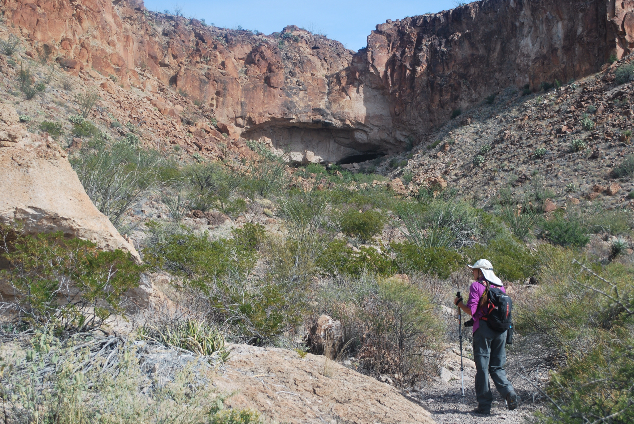
There were no established hikes from our campground, so for our first day we decided to see if we could locate a set of ruins that were identified on one of our maps. We headed off in the direction we thought we should go, up a wash, and then realized that we were on the wrong side of the wash in order to proceed. Now, usually this isn’t a problem—just cross the wash. But this one had a stream through it and was totally overgrown

So we rooted around trying to find a way through it, and low and behold we found a trail up the mountains!


So we took it. It’s not on the maps, and the park people we talked with didn’t know about it. It looked like an old horse trail. And it looked like some people have ridden their horses up this trail recently. It is amazing that they could do this because it was steep and slippery.


We followed it up over the mountain to our north and came to a small mesa with beautiful views all around. We crossed the mesa and in the distance observed what looked to be a huge cave, about a mile away.


So we went into a wash that seemed to head in that direction, and followed it to the cave.

The final 200 feet to the cave consisted of a lot of boulder scrambling, but that was because we missed a trail that would have taken us to it. (Note to ourselves: before boulder scrambling look up on both sides of the wash first to see if someone else wanted to avoid the scrambling and built a trail—this is the second time we have had to learn this lesson).


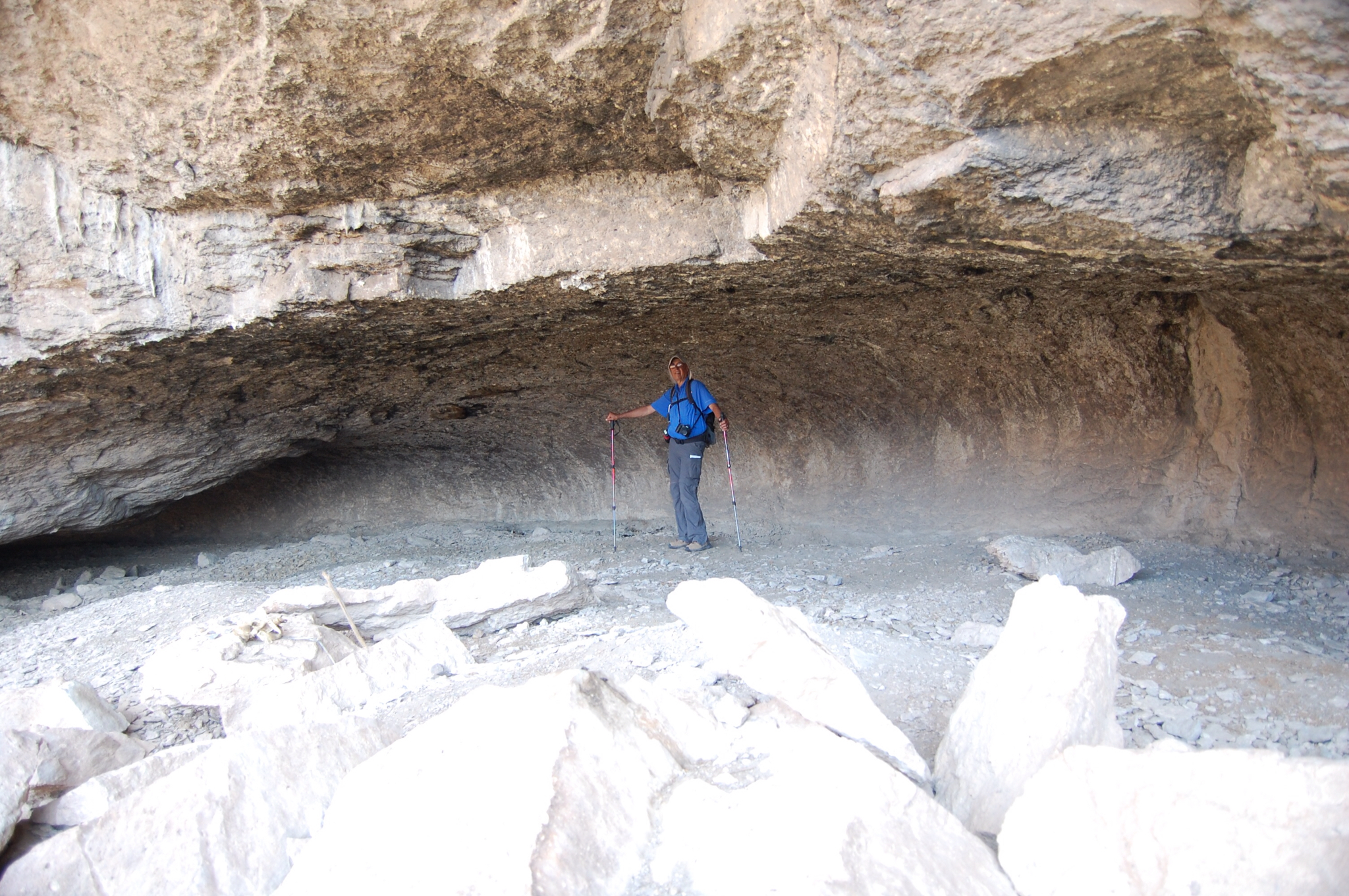
The cave was fascinating.

It is clear that large animals have inhabited it. One section was nothing but scat—we labeled it as "where poop goes to die."

It also appeared as if there had been many fires in the cave, as the roof seemed covered with soot.


Our mystery is who built this trail and why. It clearly required a lot of work—it was almost the quality of CCC trails.

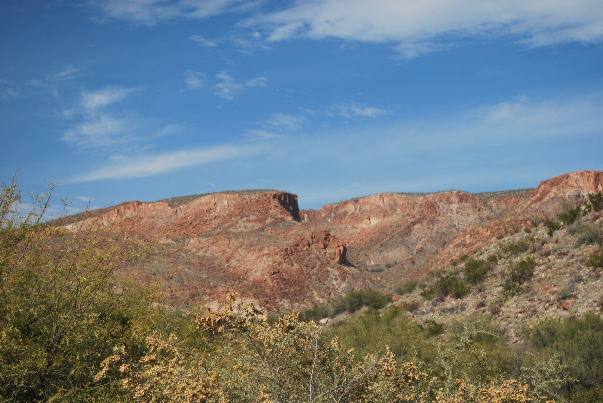
Here is a photo of the mountain we climbed. We started at the base on the right and crossed it to the top left of the photo, where we met up with the mesa mentioned earlier.